Table of Contents
- Quick Facts of The National Three Peaks Challenge
- > BOOK YOUR NEXT UK ADVENTURE EXPERIENCE HERE
- What is the National Three Peaks Challenge?
- How to complete the National Three Peaks Challenge?
- How long does it take to complete the Three Peaks Challenge?
- How fit do I need to be to complete the National Three Peaks Challenge?
- What kit do I need for the Three Peaks Challenge?
- What training should I do for the National Three Peaks Challenge?
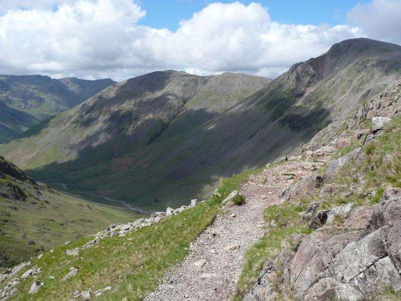
- Climbing Ben Nevis as part of the National Three Peaks Challenge
- Climbing Scafell Pike as part of the National Three Peaks Challenge
- Climbing Snowdon as part of the National Three Peaks Challenge
- National Three Peaks Challenge: Our account of completing it
Post SEO title
The Ultimate Guide to Complete the National Three Peak Challenge | Beyonk Blog
Meta description
Read on to for our comprehensive guide to the National Three Peaks Challenge and what it entails.
Quick Facts of The National Three Peaks Challenge
The National Three Peaks Challenge is the effort to climb the largest three mountains in Scotland, Wales and England, often within 24 hours, covering around:
- 23 miles (37km) of hiking
- 462 miles (743km) of driving
- 3400m (10,052ft) of ascent
Fitness level: Intermediate - you’ll need to be fit, healthy and active in order to be able to complete the challenge within 24 hours.
Read on to for our comprehensive guide to the National Three Peaks Challenge, that covers:
- What is it?
- How to complete it?
- How long does it take?
- How fit do I need to be?
- What to take and what to eat?
- What to training should I do?
- Climbing Ben Nevis
- Climbing Scafell Pike
- Climbing Snowdon
> BOOK YOUR NEXT UK ADVENTURE EXPERIENCE HERE
What is the National Three Peaks Challenge?
There are several Three Peaks Challenges across the UK, including the Yorkshire and Welsh, but the most well-known and challenging is the National Three Peaks Challenge.
Each year, around 30,000 people attempt this testing challenge to conquer three mountains in three separate countries. Around 90% of walkers complete the Three Peaks Challenge, but only 40% do so within 24 hours.
The National Three Peaks Challenge refers to climbing the highest peaks in England, Scotland and Wales. The mountains in the Three Peaks Challenge are:
- Ben Nevis, highest peak in Scotland (1,344m)
- Scafell Pike, highest peak in England (978m)
- Snowdon, highest peak in Wales (1,085m)
Some walkers choose to climb all three peaks on separate occasions, timing each individual peak and adding the times together. However, the ultimate National Three Peaks Challenge involves ascending and descending all three peaks, and travelling between them, all within 24 hours. It’s a tough mental and physical challenge!
How to complete the National Three Peaks Challenge?
There are three main ways you can attempt the National Three Peaks Challenge; with a guided group, a non-guided group or solo.
The logistics of completing the climbs and journeys within the 24-hour time limit usually means that the easiest, safest and most practical way is to join a group or a professionally organised Three Peaks Challenge event. This allows you to rest on the journey, have support in place for food, equipment and emergencies, be accompanied by an expert guide, and enjoy the camaraderie of other walkers! There’s often a chance to get a certificate at the end to supplement your well-deserved boasting rights.
You can do the challenge with friends that have some hiking experience, but it will require a lot of logistics and route planning. Hire a minibus, rope in a non-walking driver and you’ll have the makings of enough support to underwrite your safety and success. If you’re doing the Three Peaks walk over two or three days, you’ll need to book accommodation and ensure to bring adequate food and water.
For practical reasons, those who choose to complete the National Three Peaks Challenge solo usually make each climb separately over a weekend or three separate dates. They stop the clock at the completion of each descent and add the three times together for their final completion time. Amazingly, Scottish adventurer Jamie Ramsay became the first man to run the entire Three Peaks Challenge solo and unsupported. He carried all his supplies on his back, with the feat taking 13 days, 23 hours and 40 minutes.
How long does it take to complete the Three Peaks Challenge?
The National Three Peaks Challenge is typically climbed from north to south, starting with the highest, Ben Nevis, in western Scotland. Twenty-four-hour climbs usually start with Ben Nevis in the evening, Scafell Pike early the following morning and Snowdon in mid-late afternoon.
Ben Nevis is the hardest (with the highest ascent and tough terrain at times), so it makes sense to tackle it while you’re still fresh, positive and raring to go. The descent can be done in fading light as the path is relatively easy to follow. Scafell Pike is riddled with paths, making it more important to tackle in daylight. Snowdon also has several routes, from the popular Pyg Track to the hairy Crib Gogh Ridge route.
Average times taken are:
- Ben Nevis 5-6 hours
- Scafell Pike 5 hours
- Snowdon 4 hours
This equates 14+ hours of hill walking, leaving 9-10 hours to drive (or ideally, be driven!) between the peaks.
This is one of my favourite videos on the Three Peaks (although it's a beast of a challenge to use a motorbike between the climbs!)...

How fit do I need to be to complete the National Three Peaks Challenge?
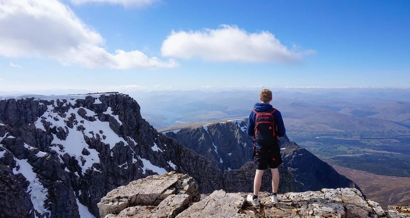
The National Three Peaks can be challenging both physically and mentally. It is a test of endurance, often requiring participants to cope with the unexpected. Bear in mind, you are not just conquering three highest mountains; you are also testing your own physical limitations and self-doubts. The reward on a clear day is breathtaking views as you stand on top of the world and celebrate your own personal victory before moving on to the next peak.
Although challengers try to choose the best weather, these three highest peaks are often surrounded by sudden mist and are covered in ice and snow as even as late as mid-June. You will be walking on rocky, loose terrain which can be slippery at times. Snow, mist, strong winds and blizzards can cause any well-planned climb to end in a rapid retreat.
The National Three Peaks Challenge requires a good level of fitness, but people of all ages and backgrounds successfully complete it every year.
What kit do I need for the Three Peaks Challenge?
If you’re off on a guided hike, your instructor will provide a full kit list (push them to do so if not). If you’re planning to do it as a group of friends, below is an indicative list of what you’ll need to bring, but you should get some practice hikes in beforehand, to get used to your kit.
- A copy of the three OS Explorer Three Peaks Challenge Maps are a must for planning your route, especially if you are not part of a guided walk or plan to go on ahead on some stages. These are OL6 (English Lakes Southwestern area), OL17 (Snowdon & Conwy Valley) and 392 (Ben Nevis and Fort William). When you buy the physical maps you will also receive a code for downloading the maps onto a Smartphone or tablet, a Three Peaks Challenge essential along with a GPS unit and /or compass.
- Fuel is essential for keeping the body going through this demanding 24-hour experience. Porridge is a good staple for breakfast along with bagels spread with peanut butter or pâté. Nuts, cereal bars and biltong (dried meat) are also good snacks to carry with you and should fit snugly in a pocket. Snacks for the bus could include tinned tuna, pasties, snickers or chocolate bars, flasks of hot drinks and around 1.5 litres water per person. It’s essential to stay hydrated, but carrying liquid is also heavy. Take a 1.5litre bottle of water in your backpack but drink more while travelling. If possible, make a toilet stop at each starting point so you don’t have to worry about practicalities on the mountain.
In terms of clothing, layers are your friend! Synthetic dries faster than cotton and a fleece underneath waterproofs is ideal. Carry an extra layer of clothing in a plastic or dry bag in your backpack. Gore-Tex waterproofs or similar, hat, gloves, sunglasses and SPF suncream will take care of the extreme conditions that you are likely to encounter during your Three Peaks Challenge. A good quality head torch is also a priority. Footwear should support the ankles, be waterproof, comfortable and broken-in to avoid blisters. Additional clothing can be left on the bus.
Other nice-to-have items are:
- A pillow for the journey
- Painkillers, hayfever tablets and other personal medication
- Sun cream
- An awesome playlist of music on a fully charged device
- Wet wipes
What training should I do for the National Three Peaks Challenge?
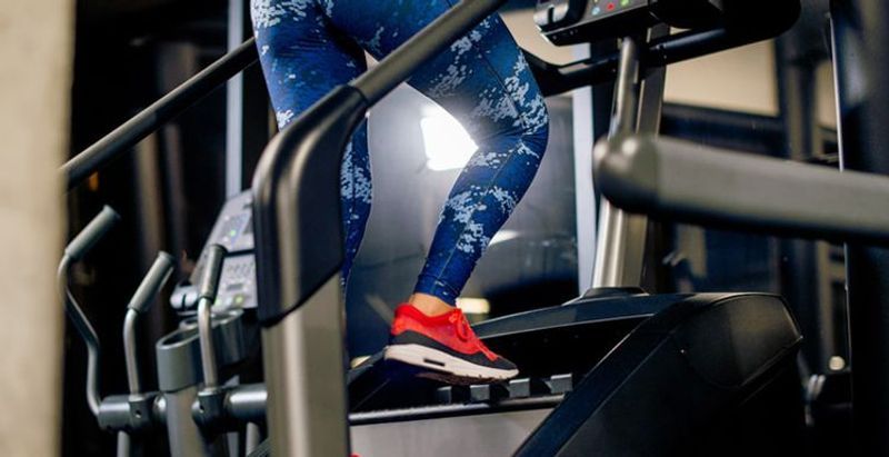
The best training for any Three Peaks participant is hill walking and getting used to being in the outdoors with changing weather conditions where you really get to try your kit / clothing out. Walking on a treadmill at full incline can help to get the legs used to climbing. General good health is necessary and mental fortitude is equally important. A positive, can-do attitude, patience and determination are all pre-requisites. Successful participants recommend mentally breaking the challenge into achievable sections and ticking them off can help walkers stay positive in their toughest moments.
Climbing Ben Nevis as part of the National Three Peaks Challenge
Unlike the other mountains of the National Three Peaks Challenge, Ben Nevis has one main path. It starts at Ben Nevis Visitor Centre car park (postcode PH33 6ST), pretty much at sea level with a steep vertical ascent up the west side. Don’t forget to feed the meter before setting off!
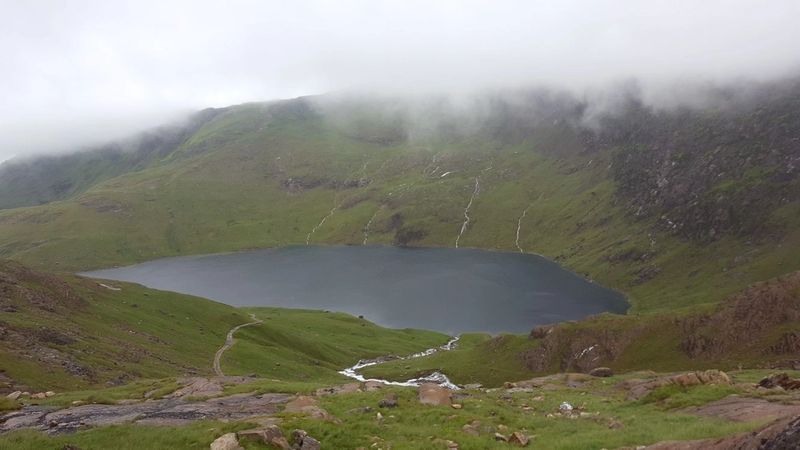
Known as the Pony Track, the route runs through Glen Nevis to Lochan Meall an t’Siudhe. This is one of the steepest sustained ascents in the whole Three Peaks Challenge and can take up 90 minutes of the overall time. The loch marks the halfway point before the path zigzags up to the rocky summit plateau. The highlight of this route is the view from the 700m (2300 ft.) cliffs on the north face of the mountain, among the highest in the UK. For much of the year, the final ascent up Ben Nevis to the trig point (triangulation station) is obscured by snow, but cairns (stone markers) highlight the path. At the peak there are ruins of a weather observatory which, remarkably, was continuously staffed between 1883 and 1904.
This route up and down Ben Nevis is 10.5 miles in total and includes 1352m of ascent. Walkers may find walking poles help with the equally steep descent.
Climbing Scafell Pike as part of the National Three Peaks Challenge
The second part of the Three Peaks Challenge up Scafell Pike is psychologically hard. Mostly rocky, the route has some areas that can be muddy and difficult to navigate in the dark. It usually starts in the early hours of the morning when the end seems a long, long way off!
The walk begins from Wasdale Head car park (postcode CA20 1EX), north of Wast Water, the UK’s deepest lake. Despite being 61m (200 feet) above sea level, this National Trust-owned lake is 79m (258 feet) deep, covering more than one square mile and reaching over 15m (50 feet) below sea level. Follow the footpath towards Lingmell Gill, bearing left uphill across the river, passing Brown Tongue and continuing to the summit boulder field. The peak of Scafell Pike is often shrouded in cloud. This route is 6 miles total (up and down) with 989m of ascent.
The alternative Seathwaite route starts near the farm at CA12 5XJ (which has limited parking). Head over Stockley Bridge to Styhead Gill then take the Corridor Route to Lingmell Col before pushing to the final peak. This route is 9.5 miles long in total and has 996m of ascent.
There are two longer routes, from Langdale and Eskdale, which are perhaps best saved for repeat challenges.
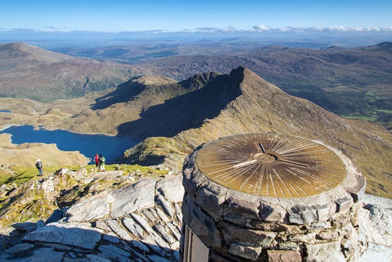
Climbing Snowdon as part of the National Three Peaks Challenge
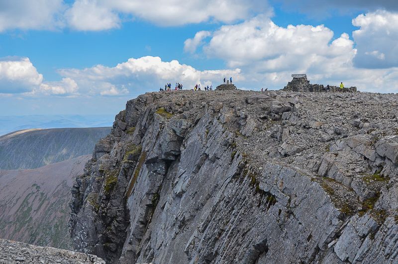
Numerous paths up Snowdon allow Three Peaks challengers to choose the route most suited to their ability and energy levels. Once challengers have reached this point, the mood is usually buoyant with the thought of the easiest climb of all and the daylight hours ahead!
Both the Pyg Track and the Miners Track start from Pen-y-Pass car park (postcode LL55 4NY) on the A4086 (Please note there is a fee for parking. Set in the Snowdonia National Park, this designated nature reserve has rare flora and fauna despite being nicknamed ‘the busiest mountain in Britain’.
The Pyg Track starts from the higher end of the car park as a tarmac footpath. It quickly becomes rocky underfoot with steps near the peak. About 30 minutes before the top, a large standing stone marks where the Pyg Track merges with the longer Miners Track. A second marker stone will lift spirits as it points toward the summit, just ahead. The Pyg Track is 7 miles in total length with a 723m ascent.
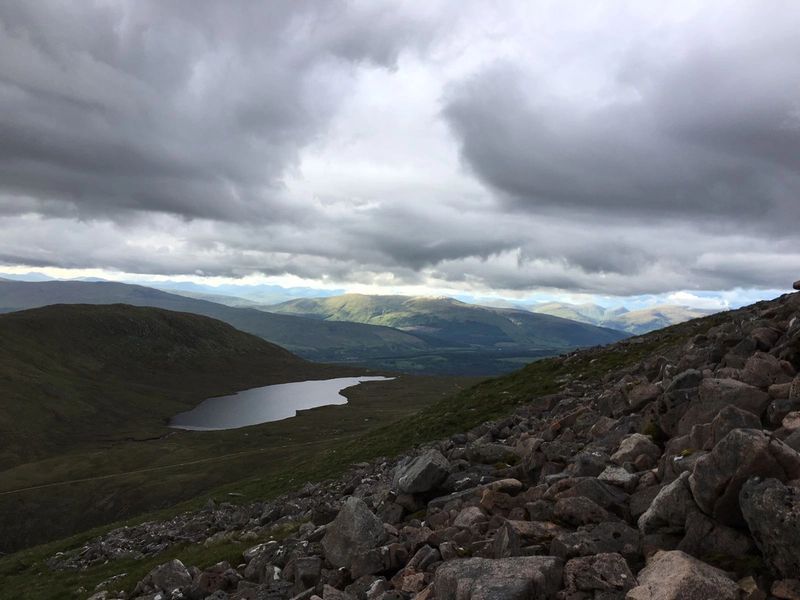
The Miners Track begins smoothly from the lower end of the car park. It winds around three lakes: Llyn Teyrn, Llyn Llydaw and Glaslyn before rising to merge with the Pyg Track about 30 minutes below the peak. This route is 8 miles in total and ascends 723m.
In summer, walkers can celebrate their successful ascent of the National Three Peaks with quick refreshments at the mountain top Visitor Centre, Hafod Eryi, before their final euphoric descent.
National Three Peaks Challenge: Our account of completing it
In June 2018, four intrepid explorers departed from London to travel up north and take on the 3 peaks challenge – climbing the 3 highest mountains in Scotland (Ben Nevis – 1,344m), England (Scafell Pike – 978m) and Wales (Snowdon – 1,085m) in just 24hrs. The 3 peaks is one of the most popular endurance events in the UK and involves not only the physical effort of scaling those mountains but also the additional pressure of doing so in no more than 24 hours, including travel time.
We had opted for the top-down approach, starting with the largest peak in the UK – Ben Nevis, moving on to Scafell Pike and finishing on Mount Snowdon. Timing is important on this one, as you need to maximise daylight hours for hiking and doing the long drive from Nevis to Scafell through the night. With this in mind, we set off just after our planned 4pm start time and up Ben Nevis we went…
With the weather looking ok, everyone was in high spirits. The mountain was busy and we met with a few fellow ‘3peakers’ along the way who brought news of poor weather forecasts on the hills to come, but given we hadn’t even climbed the first one yet it was focus on the task in hand and just be glad it wasn’t raining (miraculously) in Scotland. With just a small number of rehydration and refuelling stops, plus a few to take in the views (before the visibility closed in), up and up we went.
We managed to reach the summit in just under 3hrs, and after the obligatory quick team photo it was back down we went as temperatures dropped… As we descended, like something out of a movie, the clouds dispersed and we had the most spectacular views out across the surrounding hills and lochs. Operating at a steady pace back down (as the surface was very wet and treacherously slippery in places), everyone made it safely back to ground level for just after 9pm, with the clock at just over 5hrs. Not bad progress so far! After some restorative teas and tomato soups and a quick stretch / roll out for the muscles on we went – next up, Scafell!
At 10pm we were on the road and everyone was fairly low on energy… including the minibus, with a near empty tank. Turns out the back roads of Loch Lomond are not overflowing with fuel stations open after 10pm and shortly after midnight the minibus completely gave up in our bid to track down a station. Time to call AA and get us back in the game! For the next 5 or so hours / 253 miles, our designated driver heroically kept his eyes open through the night whilst navigating flooded roads and stray sheep! We arrived in a very, very wet and windy Wasdale to commence our second mountain ascent – Scafell Pike.
By this point the weather had severely deteriorated but, with the group adopting the “Well we’re here now so we may as well give it a go” mentality, we rallied on in in spite of the shocking conditions! We made it up as far as the gill (aka rushing river with some nice slippery water covered stones for us to cross) and were hit by a testing “Ok, how do we navigate this one moment”. Fortunately for us, one of the team kindly volunteered to sacrifice himself (and his socks) for the greater good, helping not only our team but a number of other groups safely across. Others, probably rather sensibly, decided dicing with death on a rushing river wasn’t perhaps the wisest idea and waved us off at this point. With gales of 40mph winds battering us from one side, we trudged on up the slippery stones in the wet and wild conditions.
Continuing our ascent for a short time, we spotted a sweet childish scrawl sign of encouragement on the side of a hill, telling us we were nearly there… whoever that foregone child was, that cheeky bugger was definitely having us on! It was another hour or so later before the first cairn (aka a small pile of stones that you usually see at the top of a mountain or a collection leading you to the top when there isn’t a clear path) was in sight, sadly this was only the first of what seemed to be ~512 cairns before we actually summited. It was a very brief stop on top of Scafell, with almost zero visibility in the conditions and winds so strong we were being blown all over the place and hail stones battering into our faces. With a number of slips, trips and stumbles on the way down, we made it back sodden wet and shivering to the very welcome sight of our support team, holding hallowed cups of tea and bacon sarnies.
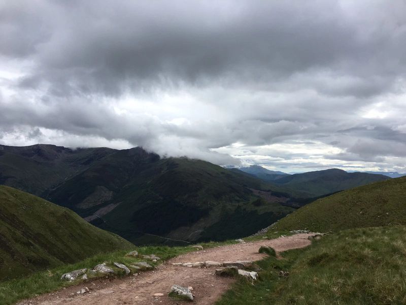
There were some questions asked over willingness to continue but with only 1 mountain left, which we were assured was the easiest of all 3 (and basically a path most of the way) on we went. At this point sadly the 24hrs was out of the question but, with stubborn determination and steely willingness the theme of the trip, by jove we were going to make it up all of those mountains! Another 203 miles and 4hrs in the minibus down to Wales with the help of the expert handling of the vehicle by our own personal Stig. Having successfully navigated the longest, narrowest, most extensively sheep filled track the satnav could have proposed, we eventually arrived at our final destination.
The weather was once again looking ominous but we took encouragement from the torrential rain looking lighter than Scafell, all about the small victories at this point! With safety in mind, it was full (cold / wet) kit back on and head torches donned to start the climb up Snowdon. Having come so far and with the finish in sight, the team were revved up and confident of a strong finish. The initial ascent offered some spectacular views plus a whole load of big steps to navigate (some almost the size of me), meaning the legs were starting to fatigue.
We were passing a lot of individuals looking much more weathered and broken than the easy(ish) start of Snowdon would lead you to believe but perhaps (as we’d seen many of the faces on the previous mountains) they were just as tired as we were and happy to be on the homeward stretch! We were soon to find out why those coming back down looked quite so dazed. If we thought it was windy up Scafell, the gusts of 60mph+ on Snowdon were later likened to being caught up in a tornado, the cold winds cutting through you like glass.
Taking turns to yell “GET LOW”, we clung to the mountain and grabbed the smaller members of our team before they could blow away. As the howling winds blew around us we crouched low against the side of Snowdon, gripping onto the sharp rocks as if our lives depended on it (because they pretty much did!).
As other teams came past us saying they’d had to turn back because it was too windy with no visibility at the top, we had a quick team huddle about the sensible decision in the treacherous conditions. The afore-mentioned stubbornness won that little debate, the consensus being we weren’t going to give up this close to the end - so on we trudged.
As we scrabbled across many a waterfall and climbed up jaggy rock surface after jaggy rock surface it was pretty touch and go, but we knew the end was nearly in sight. That final stretch to the summit was painful for everyone, crouching low as we inched forward against the gale force winds, unable to see far enough to work out where the end actually was. It was pretty dicey on top and after 5 seconds posing for a quick pic, there was a rousing call of “Let’s get off this bl%dy mountain!”.
After coming off the peak, the intention was a slow and safe descent of Snowdon, but as everyone was wet and tired with the cold setting in, there were some concerns about hypothermia amongst the group. We’d never been so glad to finally make it back to the sheltered side of the mountain, being unable to contact our driver to let him know we were taking longer than anticipated / were still alive. Safe to say he were pretty delighted to see us safe and sound to!
Boasting a final time of just over 28 hours, we were all pretty pleased to have achieved what we set out to do and honestly quite grateful that everyone was still alive / in one piece after the treacherous conditions, 1200+ mile drive and vehicle mishaps along the way.
An incredible experience and awesome challenge, the 3 peaks should definitely be on every UK adventurers bucket list!
Want to do the National Three Peaks Challenge? Explore from our UK Adventures.